
This year a new cooperation program was signed between UMSS (Universidad Mayor de San Simon), SIDA (Swedish International Development Cooperation Agency) and LU (Lund University). Within the agreement it is planned to continue the Characterisation of Aquifers in Bolivia, where the main focus will be the Chocaya Aquifer in Cochabamba. Virgilio Martinez is the new PhD student who will work in this topic. Geophysical methods, and hydrochemical and isotopic analyses will be conducted in the following 4 years in order to broaden the knowledge about the Chocaya aquifer.
MSc thesis presentation by Hannes Pilser 2020-03-11
Abstract
The Chocaya Basin is situated in the north-western part of the Valley of Cochabamba, Bolivia, where a semi-arid climate prevails. The increasing population is dependent on local aquifers for drinking water and irrigation. Wells are used to extract water. Scarce amount of rainfall, mainly during the dry season, and constructions of buildings, are reducing the infiltration of water in the soil and consequently the net recharge of the aquifers. This has resulted in deeper wells, lower groundwater levels and the risk of depleting the aquifers.
This thesis investigates the current situation of the hydrology and hydrogeology of the valley, in particular the Chocaya Basin, where a potential aquifer is located. The study area is mainly on farmland and at parts of the Chocaya River. The aim is to map the geometry of this potential aquifer.
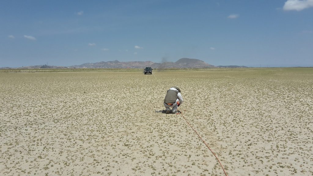
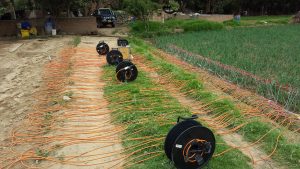
Two geophysical methods were applied, ERT (Electrical Resistivity Tomography) and TEM (Transient Electromagnetic Method). The ERT method is based on passing a current through the subsurface and measuring the resistivity of the ground, while the TEM uses transient waves that are sent through the ground. The ground acts as a conductor that induces electrical current into the surrounding material, which generates a secondary wave. Equipment at the surface registers these secondary waves and makes it possible to calculate the resistivity of the subsurface, i.e. the ability of materials to resist the flow of electrical current. Different geologic materials have different resistivities, making it possible to determine the lithology and thereby the dimension of the potential aquifer.
The use of both TEM and ERT helps to obtain more accurate results. In addition, lithology reports from nearby wells were used to characterise the top 100 m of the subsurface. The data processing showed that the TEM results in this area were more reliable. For this reason, data from the TEM were mainly used for interpretations and conclusions. The results show that the top 50–100 m part of the subsurface in the study area has a high resistivity (≈1000–2000 Ohmm). High resistivities are linked to coarse sediments such as gravel and sand. Further down, the resistivity drops to approximately 100 Ohmm.
The lithology report indicates that the sediment consists of mainly gravel and sand down to 75 m and below finer sediments become more abundant. These results of the measurements are in line with the geologic history of the valley: alluvial fan deposits on top lacustrine and fluviolacustrine sediments.
Overall, the dimensions of the potential aquifer can be linked to the high resistivities, i.e the top 50– 100 m of the ground. There, water can infiltrate and be stored in the potential aquifer.
An open surface is needed for a good infiltration of water through the local geologic material. However, there is a high demand of construction buildings due to the increase in the population, which would reduce the infiltration of water in this area for recharging the potential aquifer.
Some additional TEM and ERT measurements were performed outside of the study area. They should contribute to assess the resistivity of the bedrock and to find an explanation for the existence of a thermal spring (Liriuni) located near the study area.
MSc thesis presentation by Alexander Bergman and Mire Persmark
Alexander Bergman and Mire Persmark presented their Master of Science thesis “Rain water infiltration model of the Chocaya basin using Hydrus-1D” on Friday 2020-02-28.
Abstract
The objective of this study was to assess the rainwater infiltration process in the unsaturated zone in an alluvial plain. Particularly, this study is focused on the Chocaya basin in central Bolivia.
The hydraulic conductivity (Kfs) were obtained from in situ measurements of infiltration rate (I) performed by Double Ring Infiltrometer (DRI) test. These were compared to the hydraulic conductivities (Ks) obtained from the empirical models; Hazen equation, Beyer equation and the Rosetta module based on particle size distribution (PSD) data obtained from soil samples. The hydraulic conductivity ranged from (2.3E-1 – 3.4E-8 m/s).
The obtained soil parameters were implemented with collected meteorological data in Hydrus-1D to simulate the soil water content through a 5m deep soil column. Electrical resistivity tomography (ERT) were used to assess the sub-surface soil structure. The performance of the infiltration model simulating soil water content was compared to in situ observations from soil moisture sensors.
The results implied that the hydraulic conductivity obtained from the double ring infiltrometer test and the Rosetta module manage to recreate the soil water content better than values from the Hazen and Beyer equations.
The Hydrus-1D models were built to represent the alluvial plain during a 14-months period (2018–2020) to cover a complete rain season and dry season. According to the simulation result, the bottom flux ranges between 0-15cm yearly through the 5m soil profile. The model results are largely dependent on initial soil water content (θi) and saturated hydraulic conductivity (Ks). This demonstrate the importance of obtaining good field investigation parameters.
The study showed that using laboratory-determined soil hydraulic properties to simulate the soil water content at field scale in a stratified soil can produce inaccurate results.
Doctoral studies accomplished
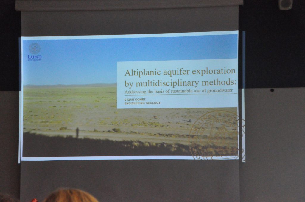
Etzar Gomez has completed successfully his doctoral studies with the defense of the thesis entitled “Altiplanic aquifer exploration by multidisciplinary methods: Addressing the basis of sustainable use of groundwater” on the 25th of October 2019.
Dr Anne Coudrain, Institut de Recherche pour le Développement (IRD), France, acted as opponent. The examination committee consisted of Prof. Sarah Cruse, University of South Florida, USA, Prof. Lars Bengtsson, Water Resources Engineering, Lund University, Sweden, and Dr. Rasmus Jakobsen, GEUS, Denmark.
New study area: Chocaya basin
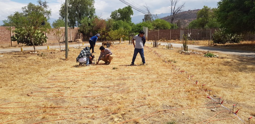
On August we have started to work in our fourth site in Bolivia: Chocaya, basin. This new area is located in the center of Bolivia, close to the Cochabamba city. Chocaya basin is an important area in terms of groundwater supply. Most of the population in Cochabamba city (approx. 1 million inhabitants) relies in groundwater. Hence, Chocaya basin was selected in order to improve the knowledge about the aquifer geometry, properties and its dynamics.
It is expected that several researches from UMSS will be involved during the research. Also, MSc students from Sweden (Hannes Pilser, Mire Persmark, Alexander Bergman, Marco Kraus, Jacob Sannum, Markus Beckman and Jeffiner Berg), and bachelor students from Bolivia are going to be part of the project. The project is part of the GWB and SIDA collaboration. Main geophysical method will be Transient ElectroMagnetics and Electrical Resistivity Tomography.

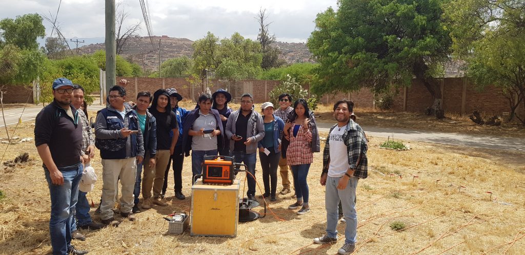
Training with MSc students from Bolivia
On mid-August a seminar of one week duration was given to master students from UMSS. The Master Course is in Water Resources Management. Andres Gonzales taught the module about hydrogeology and trained the students in performing geophysical surveys for researching water-related problems.
Doctoral Dissertation by Etzar Gomez
The thesis “Altiplanic aquifer exploration by multidisciplinary methods” will be presented on Friday, 25th October.
Abstract
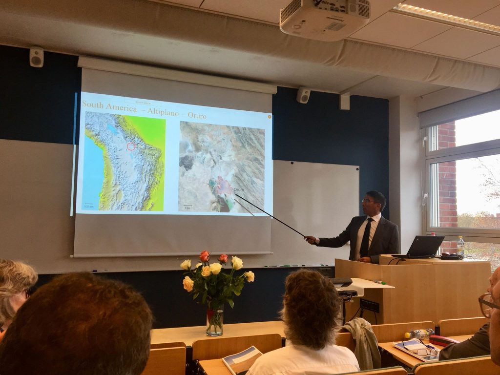
The sustainable use of groundwater relies on building up three stages: exploration, development and management. The exploration is crucial to understand the capabilities and limitations of aquifer units; e.g. volume of available water and potential yield, distinction of recharge and discharge zones, and the groundwater quality are developed in this stage. In the Altiplano, groundwater is probably the most important water resource to supply domestic consumption and irrigation, since surficial bodies have been affected by reductions linked to drought events.
The city of Oruro, Bolivia, in the Central Altiplano, is supplied solely with groundwater from a porous aquifer that has been utilized for decades; however, its hydrogeological characteristics are not fully understood due to the scarcity of data and limited resources to conduct long-term research. In order to develop the exploration of the aquifer units to the north of Oruro, this thesis presents studies aiming to fill gaps in the knowledge about their hydrogeological characteristics. A multidisciplinary approach including analysis of isotopic data and geoelectrical surveys was applied in this thesis; results and interpretations are based on data from previous studies and from sampling and measurements conducted recently within this work. The study subjects in this thesis include groundwater flow patterns inferred through isotopic characteristics, deduction of some geological features (fault mapping and delineation of bedrock) from changes in resistivity and estimation of aquifer parameters relating hydraulic properties and resistivity. Data acquisition during this work consisted of sampling and analysing isotopic compositions in water from precipitation, rivers and wells. Likewise, resistivity was obtained from surveys using electrical resistivity tomography and transient electromagnetic methods.
Two aquifers were identified in the study area: unconsolidated sediments storing freshwater, currently under exploitation, overlying fractured bedrock that holds hydrothermal flows characterised by high temperature and salinity. Groundwater in the aquifers comes mainly from precipitation on the mountains, forming rivers that infiltrate laterally into the top aquifers, the natural discharge could have been located outside the limits of the study area, to the southwest; however, the cone of depression created by the wellfield supplying Oruro captures a substantial part of this groundwater. Isotopic characteristics of water in precipitation and groundwater at different depths were analysed to infer four circulation systems: (1) a shallow one receiving minor vertical infiltration, (2) the main system circulating through the unconsolidated sediments, (3) a transitional system between sediments and bedrock and (4) the deepest one, circulating through the bedrock fractures.
Resistivity models obtained from geoelectrical surveys were analysed to infer the depth of the contact between sediments and bedrock; in the selected study area, it varies from a couple of meters to ~200 m. The shape of the bedrock is interpreted as complex and irregular. Likewise, extensions of faults underneath the sediments were detected by tracking changes in resistivity; some of them seem to be connected to the hydrothermal sources in the region. Finally, an empirical relationship between hydraulic conductivity (from pumping test) and resistivity in the porous aquifer was used to estimate aquifer parameters (hydraulic conductivity and transmissivity) in areas with available resistivity data.
The outcomes from this thesis help to improve the basic comprehension of the hydrogeological characteristics of the studied aquifer system and fill gaps in the exploration stage; the results can be incorporated into the technical analyses aiming for the sustainable use of groundwater in the Altiplano. The applied methods have proven to be adequate to the local conditions and the multidisciplinary approach used in this thesis, can serve as an example for other studies dealing with similar conditions and limitations. Extensive surveys covering bigger areas with the same methodology, presented un this thesis, would permit the completion of the exploration stage and would make possible to shift the focus to the development and management stages of the aquifer units.
Successful completion of doctoral studies
Andres Gonzales Amaya has completed successfully his doctoral studies (defense was on the 23rd of October 2018). Moreover, Andres has been employed by his local University in Cochabamba, Bolivia (Universidad Mayor de San Simon – UMSS). It is planned that by mid of 2019 a geophysical campaign will be performed in the surrounding of Central Valley of Cochabamba, within the Geoscientists Without Borders project.
Doctoral Dissertation by Andres Gonzales Amaya
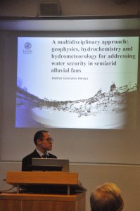
Andres is having his doctoral dissertation: “A multidisciplinary approach: geophysics, hydrochemistry and hydrometeorology for addressing water security in alluvial fans”. Tuesday, October 23, 2018.
Click here for the dissertation’s invitation and link for the thesis.
Abstract
Water security offers to the local population an adequate quality and quantity of water for health, economy, livelihoods and ecosystems. Hence, achieving basic levels of water security should be a priority in areas where access to fresh water is scarce. The Punata alluvial fan (Bolivia) is a semiarid zone and an important agricultural zone, where the main source of water is groundwater. Therefore, it is important to retrieve and broaden the knowledge about the main hydrogeological mechanisms, and the physical and chemical properties of the groundwater in the Punata fan. This research aims to apply and combine different disciplines such as hydrometeorology, geophysics and hydrochemistry to retrieve important hydrogeological information in the Punata fan. This information is of particular interest for achieving water security, so that freshwater (i.e. groundwater) can be provided to the local population, industry and environment.
The hydrometeorological results suggests that there is a cycling of El Niño events which are related to regional drought periods, hence the recharge of groundwater can be affected. Records from wells suggest that there is a lowering of the water table, which is more evident when an El Niño event take place in the same or in the previous years. Therefore stakeholders should take into consideration the occurrence of El Niño events in order to plan a more efficient usage of water. The geophysical results and interpretation are important for proposing and refining hydrogeological conceptual models, where a more accurate description of the layering, depth and thicknesses of the different aquifers units are displayed. One main finding is the delimitation of a saline layer at the bottom of the aquifer system. The delimitation of this saline layer is important in order to prevent the pollution of fresh water when drilling and pumping take place. Another application of the geophysical results is for elaboration of groundwater vulnerability maps, which are important for preventing groundwater contamination. The hydrochemical results highlight that groundwater in the Punata fan is mainly recharged by the Pucara River, while recharge from precipitation and irrigation are of less importance. The analysis of groundwater salinization suggests that saline deposits lying in the lacustrine layer are the main cause of salinization, which is also supported with the geophysical results where a saline layer was detected.
A multidisciplinary approach can produce more complete, accurate and reliable hydrogeological information in alluvial fans, where groundwater is the main source of water supply. The results and findings of this research are important for the local actors, due to the fact that a better understanding of the major hydrogeological processes is provided. Therefore, with this knowledge, further plans for sustainable groundwater management and protection can be proposed. Thereafter, if access to fresh water (i.e. groundwater) is guaranteed in the study area, basic levels of water security can be reached and with this an improvement of the local wellness.
Presentation of partial results in international congresses
Several successful presentations have been performed through the year:
- Symposium on the Application of Geophysics to Engineering and Environmental Problems (SAGEEP 2017). Colorado, United States of America. Presented by Torleif Dahlin and Andres Gonzales Amaya
- Novel Methods for Subsurface Characterization and Monitoring (NOVCARE 2017): From Theory to Practice. Dresden, Germany. Presented by Andres Gonzales Amaya
- Meeting on Hydrogeology (Flowpath 2017). Cagliari, Italy. Presented by Andres Gonzales Amaya
- Society of Exploration Geophysicists – Annual Meeting (SEG 2017). Houston, United States of America. Presented by Etzar Gomez
- 4th Annual Congress of the International Association of Hydrogeologists (IAH 2017). Dubrovnik, Croatia. Presented by Andres Gonzales Amaya
The abstracts are available in the Publication/Conference abstracts section.
Comments