Grid View

Fieldwork data acquisition at Pucarani aquifer La Paz

A new field campaign with the Ministry of Environment and Water (MMAyA) has started this week aiming to acquire geophysical data from the Pucarani aquifer. ERT and TEM measurements are going to be conducted during the coming five weeks. The research team for this campaign is formed by Nicolai Friis Mortensen (DK), Giulia De Pasquale (IT), Michelle Pedrazas (BO), Micaela Pedrazas (BO), Waldo Medinaceli (BO), personel from MMAyA and local municipalities.

2017-08-04

This entry was posted in

Uncategorized

Comments

0 Comments Leave a comment

Presentation of MSc thesis by Viktor Broman and Emil Svensson

Viktor Broman and Emil Svensson presented their MSc thesis “TEM and ERT Investigations in Challapampa Aquifer, Bolivia” Friday 16 June 13:15 at Lund University.


Abstract

In this study, electrical resistivity tomography (ERT), induced polarization (IP) and transient electromagnetic (TEM) measurements were carried out to investigate features in the Challapampa aquifer, located on the Bolivian Altiplano north of the city of Oruro. Oruro presently cannot satisfy the demand for water and Challapampa aquifer acts as the main source of drinking water for the city. The objective of this study was to investigate fault systems and thermal water intrusion in a study area located in the aquifers south eastern part.

The ERT method uses an array of electrodes, set up along the surface or in boreholes, to generate resistivity-depth cross sections of the subsurface. The time-domain IP method uses the same electrode configurations as the ERT method but instead measures potentials during charge up or directly after the current is shut down. The IP method can thus be used to determine the chargeability (or IP-effect) of a geological material.  For the TEM method, a direct current is sent through an ungrounded loop. When the current is shut off, the magnetic response of the ground is measured as induced current in receiver(s) on the surface.

Challapampa aquifer consists of Quaternary sediments of fluvial and alluvial deposits from lakes and rivers that have occupied the Altiplano for thousands of years. The bedrock that lays beneath the Quaternary sediments consists of sandstone and shale with intrusion of magmatic rock in some parts. The fault direction of the bedrock on the Altiplano shows a Southeast-Northwest trend. In the southeastern part of the aquifer within the study area there are some hot springs where the thermal water is believed to origin from fractures in the bedrock where the magmatic rock has intruded into the sandstone. In the part where the hot springs are the water is salty, which indicates that the thermal water from the hot springs leads to a salt intrusion in the southeastern part of the aquifer.

Two especially interesting areas of low resistivity were found. One in the northern part of the study area, where the low resistivity area was interpreted as a fault beneath the Quaternary sediments and one in the central part, where the low resistivity area was interpreted as a fissure system beneath the hot springs.

In some parts of the study area, measurements were planned but could not be executed due to villagers not allowing measurements to take place on their land.

2017-08-03

This entry was posted in

Uncategorized

Comments

0 Comments Leave a comment

Presentation of project results in a seminar in Cochabamba

Project results were presented by Andrés Gonzales and Torleif Dahlin in a seminar at organised by Centro Agua, UMSS, in Cochabamba on Friday 2017-03-31. The presentations included an overview of the project, preliminary results from the Challapampa and Punata aquifers plus a short introduction to the methods used.

2017-04-01

Comments

0 Comments Leave a comment


Presentation of project results in a seminar in Oruro

Project results were presented by Etzar Gomez and Torleif Dahlin in a seminar at Geology Dept., Oruro Technical University (UTO,) in Oruro on Tuesday 2017-03-28. The presentations included an overview of the project, preliminary results from the Challapampa and Punata aquifers plus a short introduction to the methods used.

2017-03-30

Comments

0 Comments Leave a comment


MSc thesis presentation by Joakim Mårdh

A TEM study, with complementary ERT, of Punata alluvial fan, Bolivia

Abstract:

The Punata alluvial fan, situated in central Bolivia (Valle Alto) between the Altiplano and the lowlands, is an important aquifer for the local rural population. Due to rapid development and population growth in the area, the demand for fresh water has increased in recent year. In combination with decreasing annual rainfall, in the already semi-arid climate, the groundwater level is steadily sinking and thus depleting shallow wells. The current solution is to drill new, deeper, wells and continue to overexploit the reservoir in an unsustainable manner. In order to map the aquifer geometry this paper presents a TEM (Transient Electromagnetic Method) survey with the aim to find the sediment – bedrock boundary, which is thought be at >300 m depth. The survey acts as a compliment to the previously conducted ERT (Electrical Resistivity Tomography) surveys in the area. Valle Alto is a tectonic basin, in the department of Cochabamba, with predominantly Palaeozoic sedimentary bedrock (Ordovician and Silurian) and minor Mesozoic formations from the late Cretaceous. The lithology varies between shales, siltstones and sandstones, deposited in a marine environment during the Palaeozoic and in a continental rift basin during the Mesozoic. Valle Alto is the result of tectonic activity during the Pliocene, which yielded an enclosed lake in the area. An unquantified amount of lacustrine clay was deposited in the basin before the lake was drained due to renewed tectonic activity. On top of the clay there is intermingling alluvial fans and colluvial deposits of different generations, with the Punata alluvial fan being one of them. In an attempt to achieve adequate depth of penetration, TEM was used in this survey. The method utilizes the fact that an electrical field always yields a proportional magnetic field and vice versa. In short, an electrical pulse is sent through transmitter loop and then abruptly turned off. This induces an electromotive force which propagate into the ground and in turn induces currents proportional to the resistivity. The currents yield a secondary magnetic field which can be measured by receiver coils, and then used to create resistivity models of the subsurface. Unfortunately, the lacustrine clay restricted the depth penetration to 90 – 200 m and the models did not reach the bedrock boundary. The survey did however present a few other interesting features such as a distinct thin layer with very low resistivity, interpreted to be brine, on top of the alluvium – clay boundary. There might also be a fault line beneath the fan, but the results of the survey are inconclusive and further studies of the tectonic regime necessary in order to verify or disregard the hypothesis.

2017-01-18

This entry was posted in

Uncategorized

Comments

0 Comments Leave a comment


Water Supply Crisis in Bolivia

There is an urgent water supply crisis in Bolivia in late 2016. The major cities in the country are struggling with water shortages, because most of their systems rely on surficial sources (dams, rivers and lakes) that have not been recharged expected. Also the climate change has been affecting the precipitation regimes. The fastest way to increase the amount of water is probably to establish new well fields for extraction of groundwater, as has been suggested by some authorities in Bolivia.

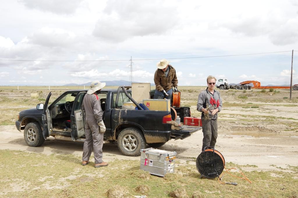
In order to achieve the goal of providing sufficient and substantial amounts of groundwater from new well fields, it is essential to perform well designed pre-investigations. All such pre-investigations must be based on conceptual geological and hydrogeological models derived from archive studies. The next step should be extensive geophysical surveying using a combination of suitable methods. In order to achieve fast enough results, under the critical present situation, airborne surveying in combination with ground-based follow-up is the only realistic option. The most adequate airborne geophysical method in this context is helicopter borne TEM (Transient ElectroMagnetic).  This should be followed up with ground-based methods, like for example ERT (Electrical Resistivity Tomography), TEM, seismics, gravimetry, etc.  Critical factors for the choice of airborne TEM system for accurate mapping of groundwater resources are resolution, stability and repeatability. The most suitable system in these respects is SkyTEM which is specifically designed for groundwater resources mapping, being developed in connection with the national Danish groundwater mapping.

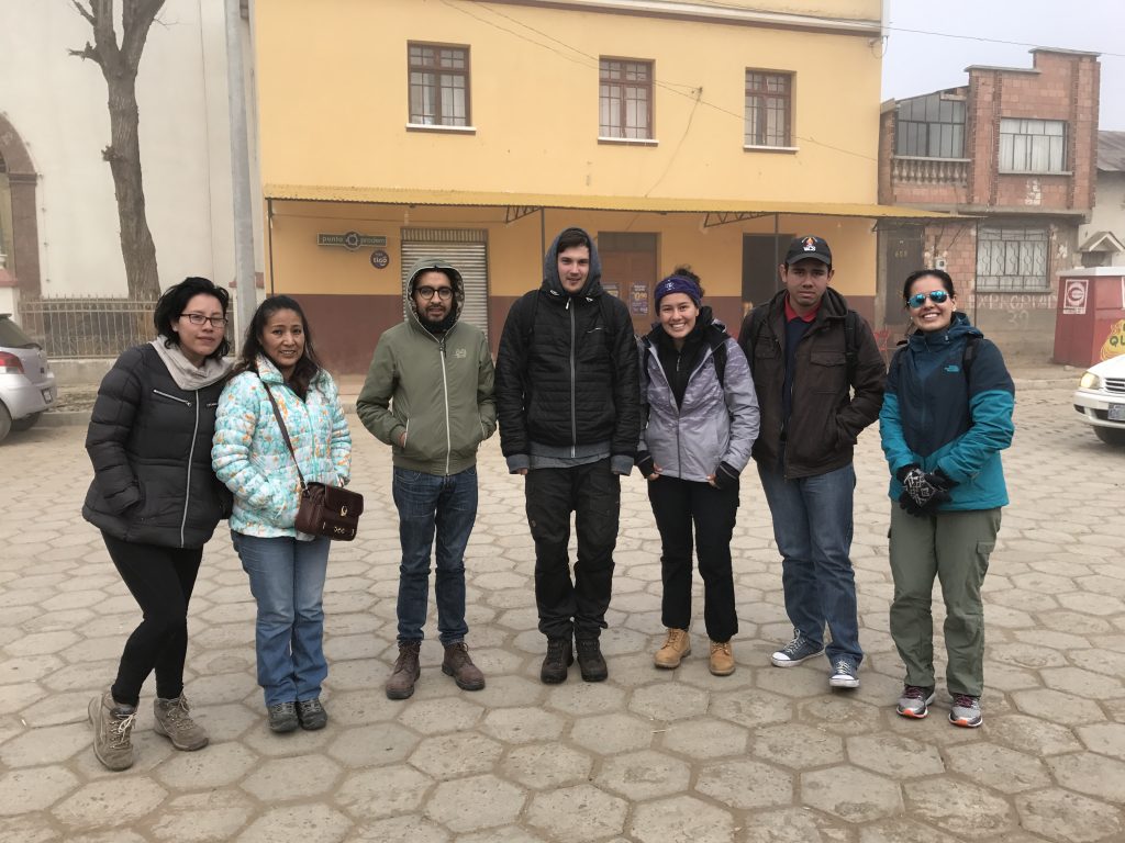
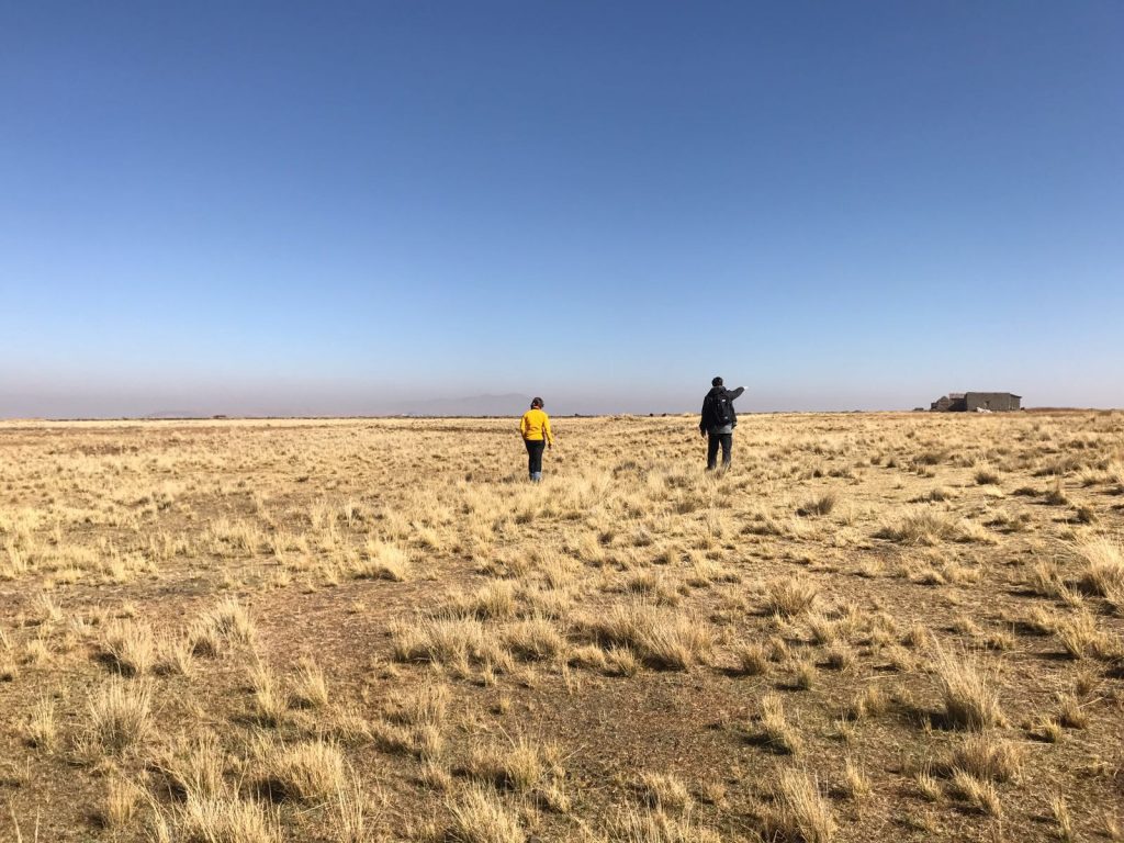
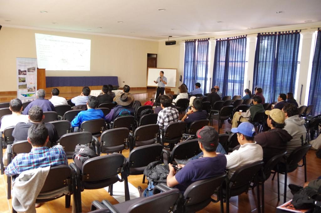
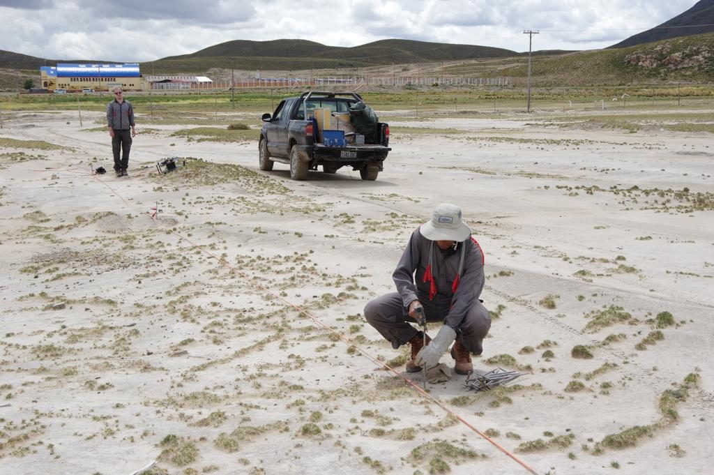
Ground-based TEM and ERT mapping of groundwater reservoirs (so called aquifers) has been carried out at the Challapampa aquifer at Oruro and the Punata aquifer close to Cochabamba, as part of research and capacity building carried out in collaboration between UMSA (Universidad Mayor de San Andres), UMSS (Universidad Mayor de San Simón), Lund University and Aarhus University. The results show that the airborne TEM method can be expected to work very well in parts of the areas without electrically disturbing infrastructure such as powerlines, which makes it most likely that the method would provide highly useful results.

Development of new well fields must be accompanied by careful studies of the recharge of the aquifers and modelling of the effects of increased groundwater abstraction, in order to ensure that the water exploitation is done in a long term sustainable way. It is essential to develop strategies for sustainable use and protection of the resources, managing the uses of surface water and groundwater in combination with conservation and more efficient use of the water regulations.

Sustainable management of water resources requires access to relevant data of sufficient quality and quantity. Such data is essential for the creation of conceptual models of the aquifers, which in turn is a step towards establishing numerical models that can be used to simulate and predict the long term consequences of different water abstraction scenarios.

Access to relevant data is generally a problem for management of groundwater resources. Data from a major geophysical data acquisition campaign followed by drilling and sampling of the aquifer material and water is very valuable in such a context. It is essential to plan and take action for long term systematic archiving of such data, otherwise it will be lost and difficult or impossible to find after few years. A national geophysical database, and a national borehole record database, should therefore be established, and it should be made compulsory to report data to it from all geophysical investigations and well drilling.

Link to article in The Guardian 21 November 2016

2016-12-15

This entry was posted in

Uncategorized

Comments

0 Comments Leave a comment

MSc thesis presentation by Måns Larsson

Måns Larsson presents his master thesis “TEM investigation on Challapampa aquifer, Oruro, Bolivia”

Abstract:
In this study a TEM investigation where preformed on the Bolivian altiplano north of the city Oruro. There is a deficit of drinking water in Oruro and the aquifer Challapampa is their main source of water. With this investigation the object was to map the bottom limitation of the Challapampa aquifer and, if possible, restraining structures within the aquifer, aquitards. The surrounding bedrock consists mainly of sandstones and shale’s that has been penetrated by intrusions in several locations. Quaternary sediments on top of the bedrock hold most of the ground-water in the area. The general structures in the bedrock surrounding the Quaternary sediments are in a northwest to southeast direction and similar structures are expected to be found underneath the sediments.
(more…)

2016-12-09

This entry was posted in

Challapampa TEM

Comments

0 Comments Leave a comment

Newer Posts